Cultural Environment
Sierra Calderona Natural Park
The Sierra Calderona Natural Park is one of the most emblematic protected natural areas of the whole Valencian geography. This extensive territory, covering 18,019 hectares, was declared a natural park on January 15, 2002.
The diversity of forest environments and the importance of species present, such as the cork oak, define this natural area as an enclave of great value, with typical Mediterranean plant species.
In Olocau you can walk through 1,370 hectares of the Sierra Calderona Natural Park with 32.3 km of trails. Olocau is the gateway to the Natural Park of the Sierra Calderona!
In addition, the Tourist Info of Olocau is a Collaborating Information Point of the Natural Park of the Serra Calderona and there you can find quality information to not miss any detail of this space.
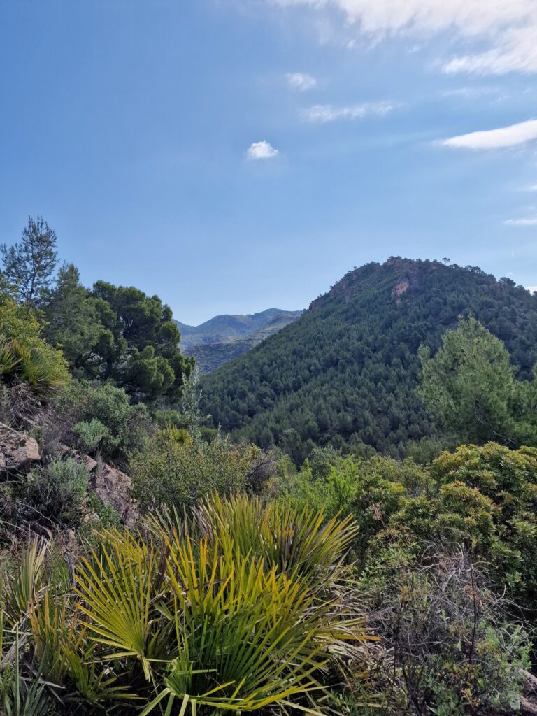
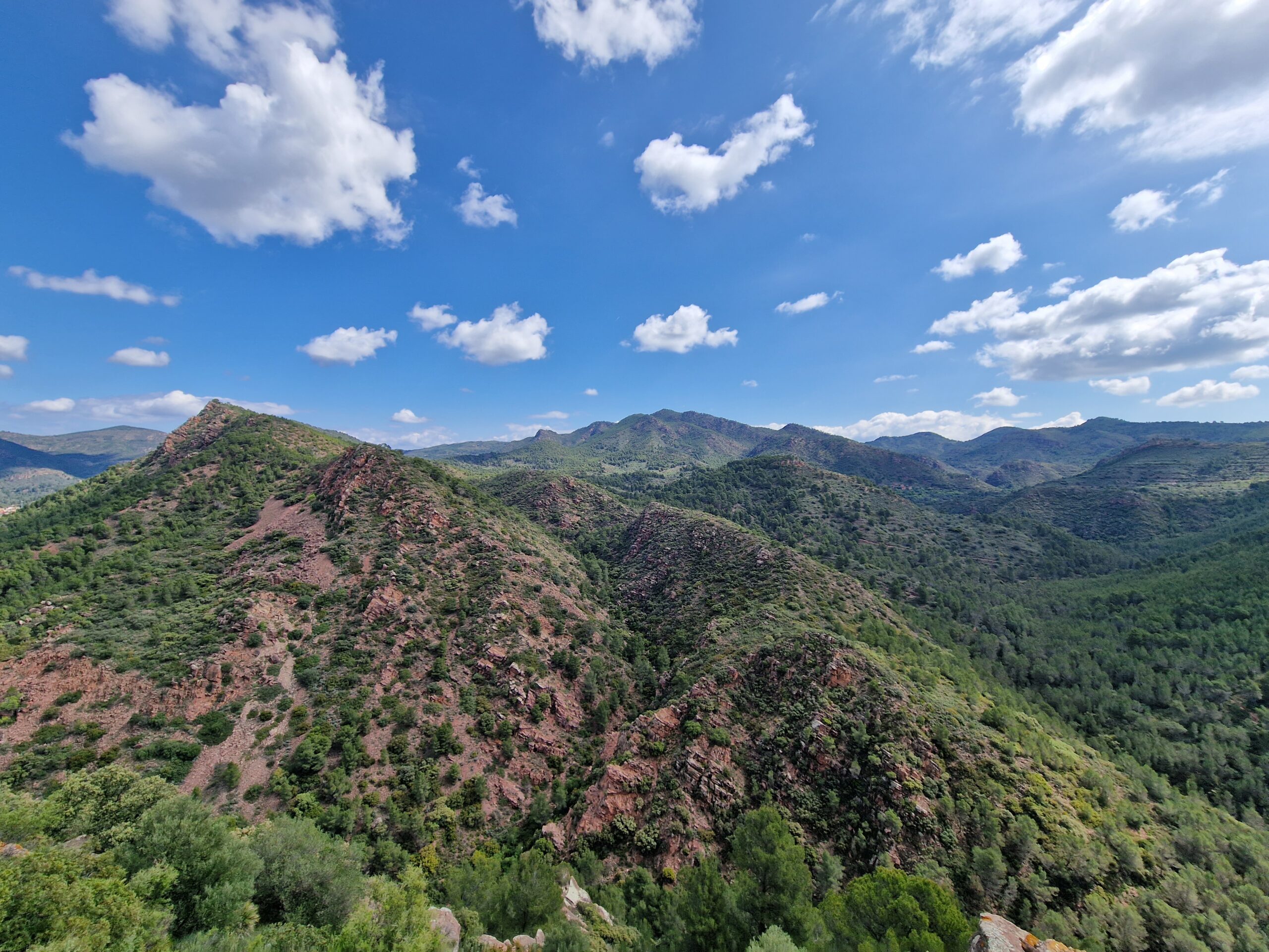
Discover the Natural Park of the Sierra Calderona with the Geological Route and the Route of Rodeno i les Amitges. These routes, together with the Castell del Real Route, will take you through an exceptional landscape environment and also discover the remains of cultures that have inhabited it since ancient times.
Geologic Route
This route runs through the Natural Park of the Sierra Calderona in its most geological and scenic side, where you will find huge breccias, conglomerates, sandstones and reddish silts.
This route is a circular route of 8 km, 170 meters of elevation gain and high difficulty, ideal for the experienced hiker looking for a new challenge. However, it also offers a shorter option that allows the charms of the Sierra Calderona to be accessible to all types of hikers.
The route starts at the Casa de la Senyoria, manor house of the s. XVIII built by the counts of Olocau. After leaving the city center, you will be able to enjoy a privileged view of the Arquet,the only preserved arch of the ancient aqueduct that transported water to the interior of Olocau. The next section of the road coincides with the one that the Counts of Olocau used to follow at the beginning of the century. XIX to access the Font del Frare, source built by Dídac de Fenollet, count of Olocau, where the nobility liked to stroll on summer afternoons.. A little further up we will find the Quebranta del Frare, a break formed by the action of groundwater on calcareous rocks. Once at the top we will leave the track behind and we enter through ancestral trails along a mountainous route in which the ravines overwhelm terraced with carob and olive trees, which were for many years the mainstay of the economy olocaunia. The geological features are not signposted, so only expert eyes will be able to enjoy their shapes and breaks.
At the end of the journey we will descend to the ravine of the Carraixet, we will return to Olocau by the old entrance road to the village from the south, a stretch shared by the Ruta de Pedralvilla, where we can observe the so-called “ghost river” dam, because it only carries a lot of water when it rains and a few weeks later.
During the tour we will find cisterns to collect rainwater and various ponds used for the local fauna. Attention to the side of the raft of the Collado Cutxara that there are remains of marine fossils, a unique witness of a remote time and a world different from the present.
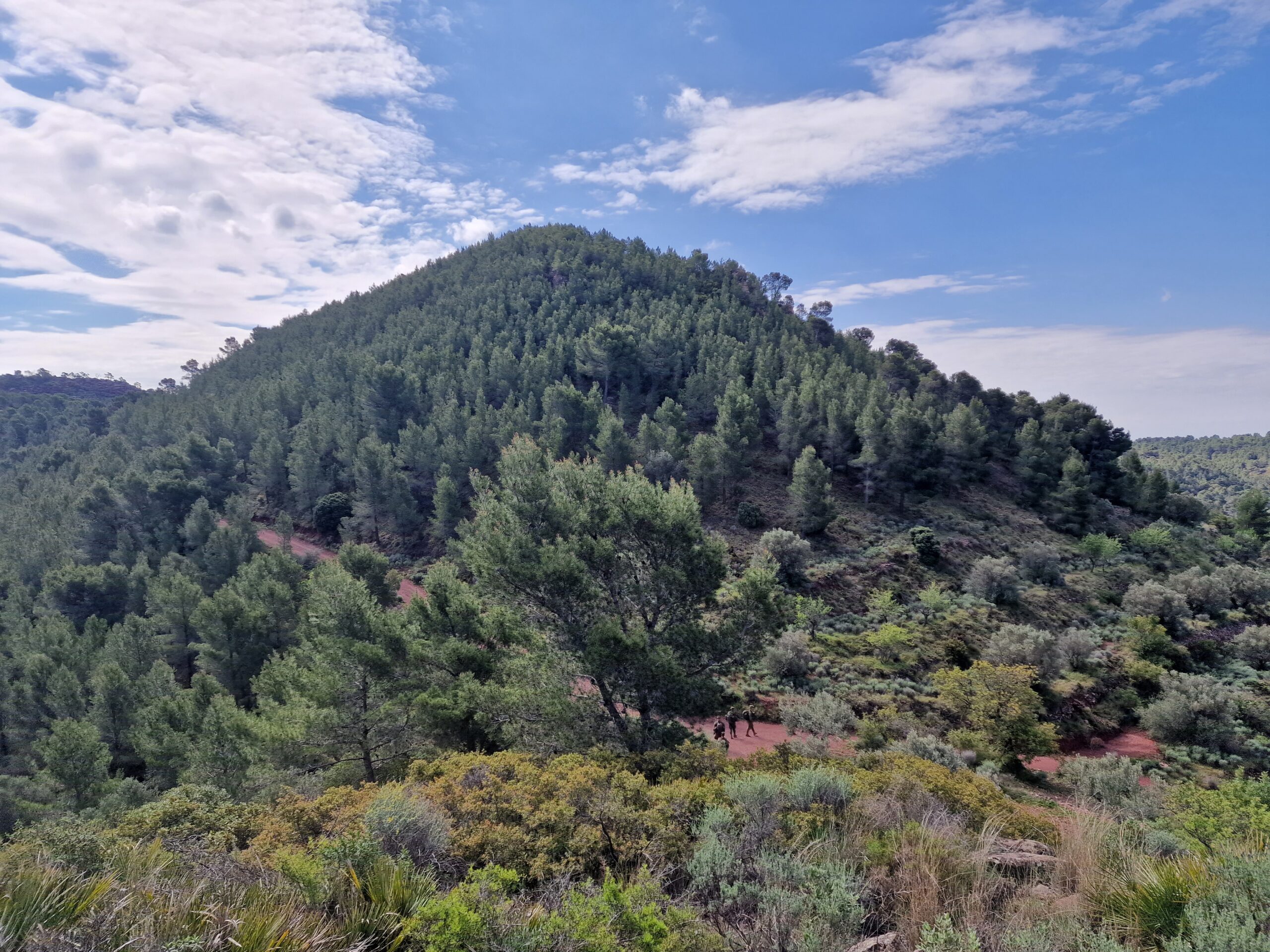
Rodeno and Amitges Route
The route of Rodeno and les Amitges is a moderate-high route that offers two circular itineraries in which to discover the botanical richness and panoramic views of the landscape of the Natural Park of the Sierra Calderona in its 13.5 km and 305 meters of vertical drop.
Starts at the Casa de la Senyoria and leaves behind the urban center along the road that the Counts of Olocau used to take to the Font del Frare, shared with the Geological Route. When these paths separate, we will enter the highest area of the municipality of Olocau and we will continue until we find the circular section of les Amitges that starts next to the corral of the sentig.
The second circular section begins near the corral del rodeno and is a section of important vegetation and landscape richness. You will be left speechless by the Quebrantà Rodeno del Cantal and the panoramic view of the Castillo del Real. At the end of this circular section you will meet again the Font del Frare and you will return by the same path of the beginning to the urban nucleus of Olocau.
The most representative tree of the route is the pine tree: two species, the Aleppo pine (pinus halepensis) and the Red Pine (pinus pinaster), the change from one to the other will indicate the change of soil type.
Olocau Tourism Routes
Pedralvilla Route 11,45 kilometers – Easy
The Geologic Route d’Olocau 9,95 kilometers – Hard
de les Fonts Route 3.2 kilometers – Easy
Route of Rodeno i les Amitges 12.52 kilometers – Hard
Ruta de les Macollades 4,93 quilometers – Easy
Castell del Real route 7.43 kilometers – Moderate
Puntal dels Llops Route 5.64 kilometers – Easy


